[ Return ]
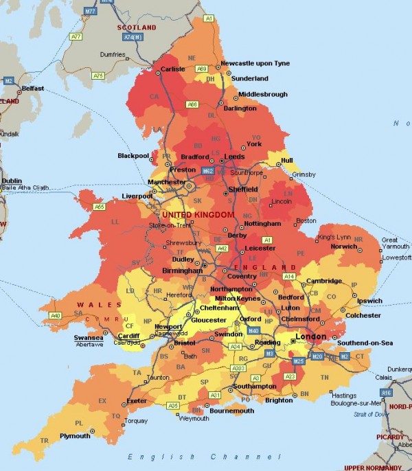
I've found this wonderful map of UK 'travel to work' areas which denote regions whereby 75% of the people live and work locally, thus delivering a map of regional employment hubs by their employment reach. https://geoportal.statistics.gov.uk/Docs/Maps/Travel_to_work_areas_(UK)_2011_map.pdf Two big changes I've noticed Expansion of Cambridge all the way down to the north of London. Surprising emergence of Slough and Heathrow cutting into London commuters. General interesting maps thread? Please note the attached map is one of BNP members per postcode area.
Cheers Search.